Subject: North America
Period: 1780 (circa)
Publication: Raynal's Atlas de toutes les parties connues du globe terrestre
Color: Hand Color
Size:
12.5 x 8.3 inches
31.8 x 21.1 cm
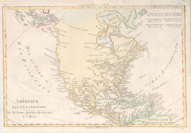
The entire western part of the continent is left mostly blank on this map of North America. In the west the map locates the Straits of Juan de Fuca, Cape Blanco, S. Pedro and Santa Fe. Indian tribes occupy the edges of defined territory -- Apaches, Sioux, Outagamis, Assenipouels. The British Colonies and a few major cities are named along the eastern seaboard and in the Great Lakes region. Alaska is shown as a group of islands, the largest of which is labeled Alaschka. Good detail of the Great Lakes and the Mississippi and Missouri Rivers. Information and place names fill Mexico and the Caribbean. Six distance scales at upper right.
References: Seller & Van Ee #170.
Condition: A
Delicate impression and coloring on thin hand laid paper with large "ABM" watermark.