Subject: Western Hemisphere
Period: 1817 (dated)
Publication:
Color: Hand Color
Size:
23.7 x 18.8 inches
60.2 x 47.8 cm
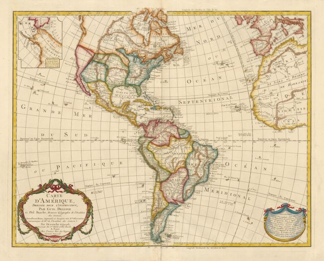
This is a later, updated edition of one of the most popular maps of the 18th century. It was first issued by Delisle in 1722 and went through 19 different versions according to Tooley. This is a version not mentioned by him, which would make it 20 versions. The United States is shown with the unorganized Louisiana Territory not reaching the Pacific coast. The map shows a number of spurious mountains ranges in the West, going east to west and north to south, and sometimes doing both within the same range. The northwest coast of North America shows Vancouver Island and Nootka and an inset continues the depiction of the coastline with an early configuration for Alaska based on the explorations of Capt. Cook.
References: cf Tooley (Amer) p. 16, #17 & 18.
Condition: B+
There is an old paper repair on the lower centerfold and a very small puncture at center. Otherwise the map is in fine condition and appearance.