Subject: Colonial Southeast
Period: 1645 (circa)
Publication:
Color: Hand Color
Size:
19.8 x 15 inches
50.3 x 38.1 cm
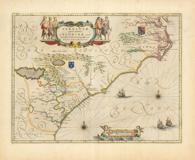
This striking map of the Southeast is based on the Hondius map of 1606 with marked improvements in the northern part of the map. It is largely from the work of Hessel Gerritsz and unknown English sources. In the Chesapeake Bay area Newport News (Newport Nesa), founded in 1621, is named for the first time, along with Bermouth, Stortingen and Arglas. The cartography in the southern part of the map remains unchanged with three imaginary lakes shown, the largest draining through the Carolinas via the May River. The map depicts the English and French colonial interests in the region by their respective royal coat of arms and several new settlements are noted. The map is adorned with a colorful cartouche showing six Indians in full regalia. The Atlantic Ocean contains two compass roses, three sailing ships and two winged children of the sea holding the German scale of miles. German text on verso.
References: Burden #253; Cumming (SE) #41; Goss (Blaeu) #74.
Condition: A+
Sharp impression and lovely old color.