Subject: United States
Period: 1878-1910 (dated)
Publication:
Color: Printed Color
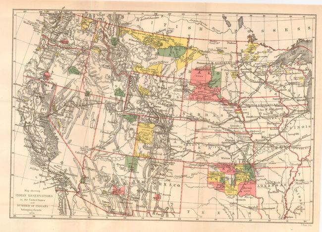
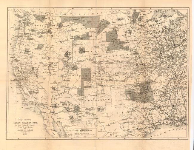
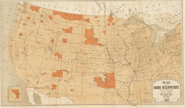
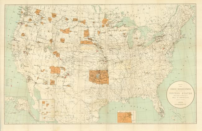
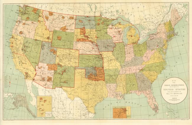
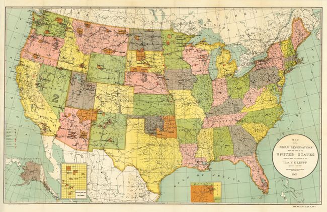
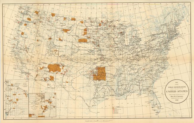
This lot is a nearly complete run 1878 to 1910 lacking only the maps from 1886, 1905 and 1908. The title is representative because in some years the title varies slightly. Sizes vary as well, between 23" x 15" up to 33" x 21". We've never seen as complete a set of these important and historical maps. Each are colorful maps showing reservations across the United States, locating towns, railroads, military stations, schools, and Indian agencies. Most have insets providing additional details of Indian Territory, Mission Ind. Res. of California, Alaska, etc. A unique offering of 30 maps that graphically describe the state of Indian Reservations over the course of more than 30 years.
References:
Condition: A
All are very good to fine. Some tape repairs on verso to 1878, 79, 80, 84, 90, and 97. The 1881 map has a small chip with minor loss.