Catalog Archive
Auction 129, Lot 809

"A New and Accurate Map of Africa, Drawn from the best Authorities", Bowen, Thomas
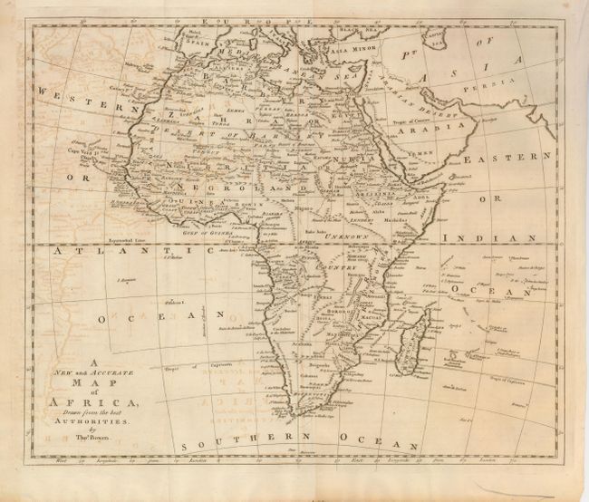
Subject: Africa

Period: 1787 (circa)

Publication: Banke's New System of Geography

Color: Black & White

Size:
16 x 13 inches
40.6 x 33 cm
Download High Resolution Image
(or just click on image to launch the Zoom viewer)

This copper engraved map of the continent reflects very little European penetration into the interior, which is marked Unknown Country. The Nile is still shown with its headwaters in two lakes located in the Mounts of the Moon above the equator.

References: Tooley (MCC-47) p.28.

Condition: B

Issued folded, now flattened. There is some offsetting and light toning.

Estimate: $150 - $200

Sold for: $100

Closed on 9/23/2009

Archived