Subject: Holy Land
Period: 1792 (dated)
Publication: Atlas Geographique et Universel
Color: Hand Color
Size:
23.3 x 19.5 inches
59.2 x 49.5 cm
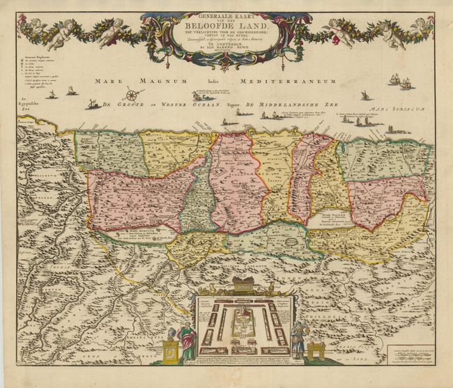
Large, detailed map of the Holy Land based on De Wit's map. West is oriented to the top of the map, which is spanned by a large title cartouche draped in a garland held aloft by six cherubs. The Mediterranean is filled with various types of ships and boats, including a depiction of Jonah and the whale. The map is divided into the twelve tribes of Israel. Several roads are depicted and the route of the Children of Israel through the desert. At bottom center is an engraving of the Tabernacle surrounded by the twelve tribes and flanked by Moses and Aaron.
References: Laor #268.
Condition: A
Fine impression and original color. Overall very good with just a few unobtrusive, light spots and an old paper repair on the bottom fold, affecting only the blank margin.