Subject: Britain
Period: 1749 (dated)
Publication:
Color: Hand Color
Size:
21.3 x 18.5 inches
54.1 x 47 cm
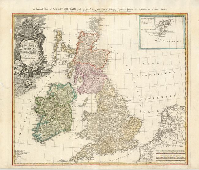
This handsome copper engraved map of the British Isles includes very good detail of Ireland, England, Scotland, Wales, and the island groups of Orkney and the Outer Hebrides. The map extends to include the adjacent parts of Holland and Belgium with five distance scales below. At upper right the inset chart details the Shetland Islands. A key at lower left includes symbols for cities, towns, villages, universities, forts and redoubts. The large, ornate title cartouche is decorated with a sea monster, shells, a coat of arms and the accoutrements of battle. Titled in English along the top of the map.
References:
Condition: B+
Very nice example on thick hand laid paper with wide margins at top and sides, delicate impression and original or early hand coloring. A little ink ghosting from printing and a small water-stain at upper center just into border.