Subject: Portobello, Panama
Period: 1763 (circa)
Publication: Atlante dell' America…
Color: Black & White
Size:
10.2 x 7.6 inches
25.9 x 19.3 cm
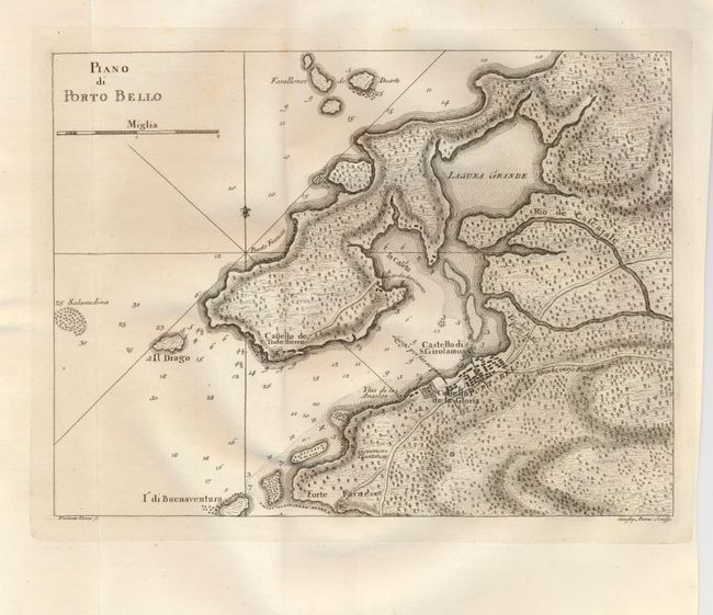
This is a handsome and beautifully engraved chart of historic Portobello Bay, which was a Spanish transfer point for gold and silver coming from South America. It locates Forte Farnese on the point, the Governors Plantation, and presents the town in a simple block pattern. Adjacent to the town is the fortified Castello de la Gloria, and across the bay is the Castello de Todo Hierro and a few other buildings. The roads are well detailed including the Strada verso Panama, which extends off the map on its way to Panama City. In the ocean are a few rhumb lines and a fleur-de-lis. Drawn by Viol. Vanni and engraved by Giusep. Pazzi. This is a scarce Italian-produced map.
References:
Condition: A
Early, dark impression with full original margins. Near the top there is a little diffuse and light foxing, otherwise a fine example.