Subject: New York
Period: 1854 (dated)
Publication:
Color: Hand Color
Size:
24 x 19.5 inches
61 x 49.5 cm
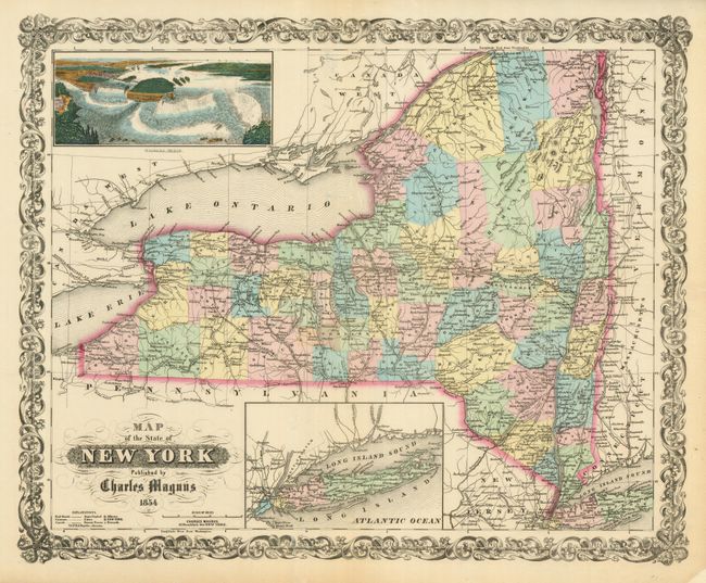
This scarce piece is a dramatic and decorative map of the state that includes a beautifully colored birds-eye view of Niagara Falls at upper left. The map is colored by county with much detail of towns and villages, canals, railroads, wagon roads, watershed and more. A second inset shows all of Long Island on the same scale as the main map. The titling is in fancy text with flourishes and banknote-style pattern behind. A wide, handsome border surrounds. Blank verso. An uncommon map by Charles Magnus, 12 Frankfort Str. New York. The map appears to have been issued separately or perhaps in a pocket map format although there is no overt evidence of it having been attached to covers.
References:
Condition: A
The map image, color and impression are fine. The map is on fine, thin paper with wide margins that have a few short edge tears, most closed on verso with archival tissue.