Subject: Eastern United States
Period: 1800 (circa)
Publication: Voyage dans les Etats-Unis… (Travels through the United States)
Color: Hand Color
Size:
17.8 x 15.5 inches
45.2 x 39.4 cm
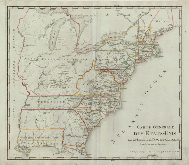
This is a French edition of the general map of Rochefoucald Liancourt's travels in the United States. The entire map is in English, only the title is in French. The map extends south to include part of East and West Florida. The western boundary of Georgia extends to the Mississippi River. A thin strip of land extending westward between Georgia and Tennessee is called United States Territory. This region originally belonged to South Carolina but was ceded back to the United States in 1787. Further south a wide strip of land between Georgia and West Florida is Land glaimed (sic) by the United States referring to the disputed region between the United States and Spain. The map is filled with a remarkable number of place names and details including a well developed road system in the nascent nation.
References: cf Phillips (M) p. 873.2
Condition: B+
This map is in much finer condition than this issue is normally found. The map image is near fine with just a little foxing or soiling at lower right corner mostly restricted to blank margin. Dark impression and original outline color on a sheet of hand laid paper.