Catalog Archive
Auction 128, Lot 383

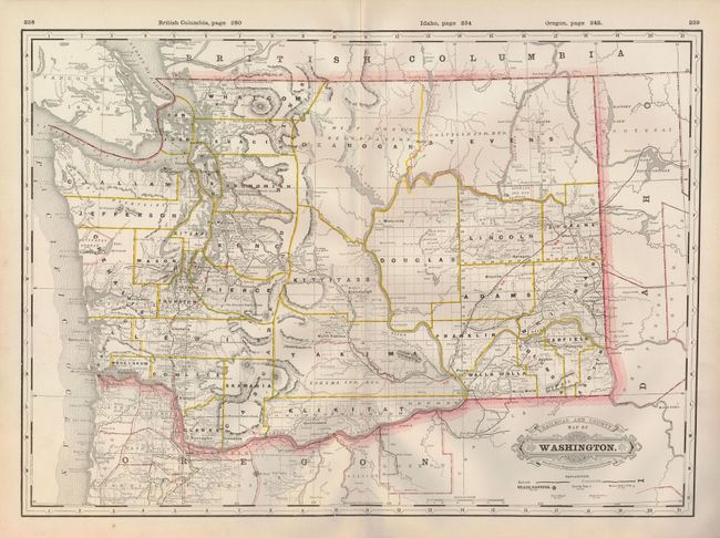
"Railroad and County Map of Washington", Cram, George F. & Company
Subject: Washington

Period: 1888 (published)

Publication: Standard American Railway Atlas

Color: Printed Color

Size:
21.8 x 15.8 inches
55.4 x 40.1 cm
Download High Resolution Image
(or just click on image to launch the Zoom viewer)

Large and very handsome map of the state with fine political and topographic detail and emphasis on the developing railway system. The map includes several small towns not shown on many atlas maps of the period. The progress of surveys is shown in all but the northwestern part of the state, which is still mostly Indian reservations. This is one of the most attractive late nineteenth century maps with a fancy Victorian title block.

References:

Condition: A+

Estimate: $90 - $120

Sold for: $100

Closed on 5/20/2009

Archived