Subject: Texas
Period: 1825-27 (published)
Publication: Atlas Universel
Color: Hand Color
Size:
19.8 x 18 inches
50.3 x 45.7 cm
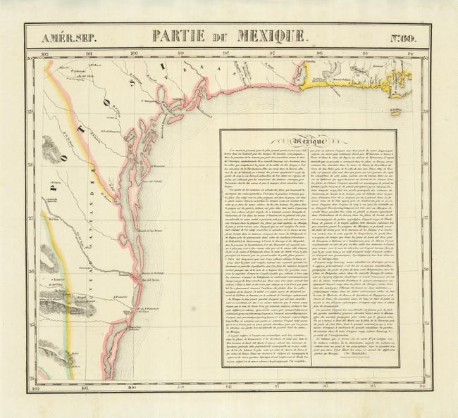
This is one of the earliest accurate maps devoted specifically to the Texas coast. The information was gathered from Spanish sources and Humboldt’s Carte Generale...Nouvelle Espagne (1809). There is a jumble of islands dotting the coast from Galveston Bay (here called Baie Trinidad) to the mouth of the Rio Grande (Rio del Norte). Laredo, San Antonio, Galveston, and Ft. Matagorda are located but there is no sign yet of any Anglo settlements. In addition to the Texas coast, this elegant map shows a small part of Mexico and Louisiana. A large box at right contains extensive text on mining in Mexico from Humboldt.
The Atlas Universel was the first atlas to present all the maps on the same scale (1: 1,641,836) about one inch to 26 miles, with each map covering an area of approximately 20 degrees longitude (from Paris) and 6 degrees of latitude. It was also considered to be the first lithographic atlas ever published. The maps were meant to be joined together to form a huge globe measuring 7.775 meters in diameter. Only one edition of the atlas was published in 1825-27, and the subscription list shows that just 810 copies were sold; thus the maps are very scarce on the market today.
References:
Condition: B+
Sharp impression with original outline color and a couple very unobtrusive spots.