Subject: California
Period: 1853 (dated)
Publication: U.S. Pacific Railroad Surveys
Color: Black & White
Size:
72 x 24 inches
182.9 x 61 cm
During the 1850s, the U.S. government sponsored an extensive series of expeditions designed to gather information on the vast new territories that had been acquired in western North America. The discovery of gold in California further stimulated westward traffic and heightened the need for a faster and more convenient way to bring the far-flung parts of the country together. In 1853 Congress commissioned the Army's Topographic Bureau to conduct a series of surveys to find a suitable route for a transcontinental railroad. There were six major expeditions; five of them covered the area between the Great Plains and west coast, and the sixth explored the coastal states of California and Oregon. All of these expeditions were accompanied by naturalists and artists to document the landscape, flora and fauna along the route.
The reports, maps and lithographs were published in the 13 volume report "Explorations and Surveys to ascertain the most practicable and economical route for a Railroad from the Mississippi river to the Pacific Ocean."
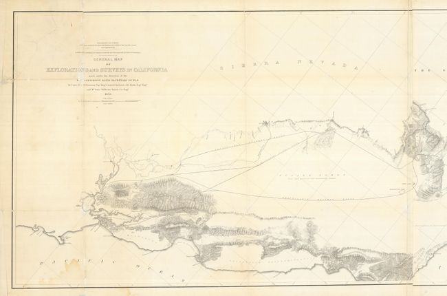
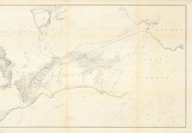
Wheat calls this a "monumental document, and is noteworthy that with few exceptions, railroads today follow its 'Practicable Railway Routes.'" This large and fascinating map describes the early railroad surveying in California and covers the region from Bodega Bay in the north to below San Diego. The Practicable Route is shown from Ft. Yuma, Arizona to San Francisco and Martinez just across the bay from Benicia. Two parties explored these routes, one led by Lieut. R.S. Williamson and another by Lieut. J.G. Parke. With several parallel routes suggested in most areas, the parties commonly explored the route through the Los Angeles and San Bernardino area. Many towns and missions are located. Good topographical detail; some areas are noted as not having been "explored instrumentally" while the "size and position are not accurately known" for Tulare Lake. On two sheets joined, as issued; imaged in two parts. This is an important map with much historical information.
References: Wheat (TMW) #877.
Condition: B
A surprisingly clean example without fold toning as normally seen. The map was folding, but is now backed with tissue to support fold splits and some tears including multiple ones in the title area with some infilling.