Subject: Northwest Pacific Coast
Period: 1855 (dated)
Publication:
Color: Black & White
Size:
22.3 x 24.5 inches
56.6 x 62.2 cm
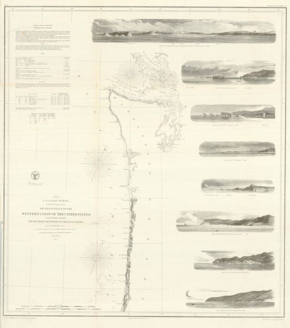
This terrific chart delineates the coast from the first official scientific reconnaissance of the Pacific coast, one of three prepared by Lieutenant James Alden for this important survey. This sheet covers the region from the boundary with Canada south past the Columbia River, Cape Foulweather and south to the Umpquah River near today's Reedsport and the historical Umpquah Lighthouse. Good detail of soundings in the complex waterways of the Straits of Juan de Fuca, the San Juan Islands, the Gulf of Georgia and Puget Sound. The chart outlines the coastal littoral, shows dangerous reefs and shoals, gives offshore bathymetric soundings, plus general and specific harbor sailing instructions. The most impressive feature is the eight views of entrances and promontories along this rugged coastline - among them, Flattery Rocks, Tillamook Head, Destruction Island, Cape Lookout and the entrance to the Columbia River and Cape Disappointment. The map was drawn by W.M. McMurtie and engraved by G. McCoy, J.V.N. Throop and apprentice J.J. Knight. One of the finest Coast Survey charts produced.
References:
Condition: B+
The map image is fine on bright, clean paper, but there are a few fold splits that will benefit from backing the map.