Subject: England
Period: 1675 (circa)
Publication: Britannia
Color: Hand Color
Size:
16.5 x 13 inches
41.9 x 33 cm
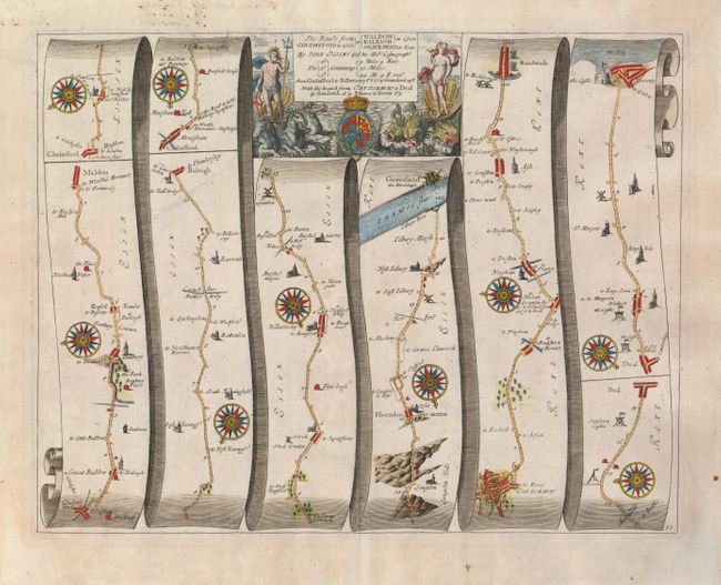
John Ogilby's 'Britannia' was published between 1675 and 1698. It is a landmark in the mapping of England and Wales. Its unique format constituted the first national road-atlas of any country in Western Europe. It was composed of maps of seventy-three major roads and cross-roads, presented in a continuous strip-form, on a uniform scale of one inch to a mile. Each beautiful map includes wonderful detail of the countryside with each strip containing a large compass rose to indicate changes in direction.
A very nice strip-style road map that details the route from Chemsord to Gravesend on the Thames. The last two panels detail the side branch from Canterbury to Dover. Filled with details, it includes villages, bridges, castles, windmills, river crossings, hills and much more. This fine sheet is decorated with numerous compass roses and a boldly engraved title cartouche featuring the royal coat-of-arms flanked with figures including Neptune on a chariot pulled by three sea horses.
References:
Condition: A
Manuscript text on verso with a little bleed through in upper margin. Good impression with original margins and watermark.