Catalog Archive
Auction 127, Lot 440

"A Chart of the Atlantic Ocean, Exhibiting the Course of the Gulph Stream. &c.", Franklin, Benjamin

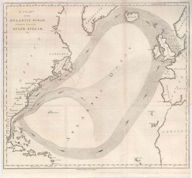
Subject: Atlantic Ocean

Period: 1834 (published)

Publication: Memoirs of the Life and Writings of Benjamin Franklin

Color: Black & White

Size:
14 x 12 inches
35.6 x 30.5 cm
Download High Resolution Image
(or just click on image to launch the Zoom viewer)

This interesting map of the Atlantic depicts the Gulf Stream and prevailing wind currents as Benjamin Franklin presented in this edition of his memoirs which was published though many years. The two portions of the Gulf Stream are shown with different style lines, arrows suggesting the current's direction. The map covers the Atlantic Ocean to include the coasts of North America, Africa, Europe, Great Britain and Norway. It shows Iceland, Greenland, Cuba, the Bahama Islands and the Antilles Islands. Published by McCarty & Davis in Franklin's home town of Philadelphia.

References:

Condition: B+

Issued folding, now pressed. A one inch tear at binding trim is closed on verso.

Estimate: $150 - $200

Sold for: $160

Closed on 2/25/2009

Archived