Subject: Hispaniola
Period: 1724 (dated)
Publication:
Color: Hand Color
Size:
24 x 16.5 inches
61 x 41.9 cm
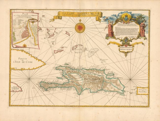
This rare map covers Hispaniola in great detail and extends to include information on the islands and sea lanes through the southern Bahamas and Turks & Caicos Islands. An inset plan titled, "Plan de la ville Espagnole de S. Domingue et d'une partie de ses environs," is shown in scroll-form in the upper left corner. A superb cartouche at right includes a dedication to the Marquis d'Asfeld, who was director-general of the French fortifications. Frezier was a French military engineer, mathematician, intelligence officer, and explorer who spent much of his career planning fortifications for the French colonies around the world. He was the chief engineer (Ingeniur ordinair du Roi) to Hispaniola between 1719 and 1728 when he made this map and plan of the city of Santo Domingo.
References:
Condition: A
The map has been trimmed about 1/4" from the neatline and remargined with contemporary paper for inclusion in a composite atlas, which was a common practice at this time. There is some faint foxing in the wide, blank margins.