Subject: Alabama
Period: 1834-42 (dated)
Publication:
Color:
Nice pair of maps of Alabama eight years apart show many county changes.
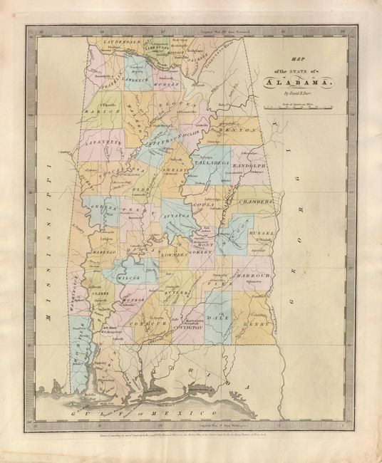
The David Burr map (1834, 10.3 x 12.6") is hand colored by county and is finely engraved. It delineates roads, towns, villages and settlements, ports, watershed and more. Surrounded by a keyboard-style border, it has fancy titling. Burr was appointed to be topographer to the U.S. Post Office Department in 1832 and was unable to complete the maps for his atlas. Thomas Illman assumed responsibility to complete the atlas, publishing it using the New York firm of D.S. Stone. The imprint of Thomas Illman is below the neatline. Published in A New Universal Atlas.
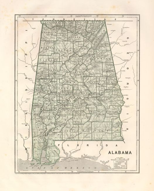
The Morse/Breese map (1842, 11 x 14") is an early printed color map that covers the state in fine detail including the major roads, watershed, towns and villages, Mobile Bay and the Gulf coast. Legend keys to towns, canals, railroads, and common roads. The map was produced by the cerographic process, the first method used for printing maps in color. The process proved to be too expensive at the time it was introduced by Morse & Breese and did not come into general usage until the latter part of the nineteenth century. Published in Morse's North American Atlas.
References:
Condition: A
Both are nice examples. The first has a spot in Clarke County otherwise near fine. The second is fine less some light foxing or staining in uncolored area near left margin and another in upper margin and into border.