Subject: Southwestern United States
Period: 1856/57 (dated)
Publication:
Color: Black & White
Size:
32.3 x 22.5 inches
82 x 57.2 cm
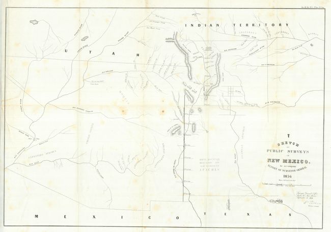
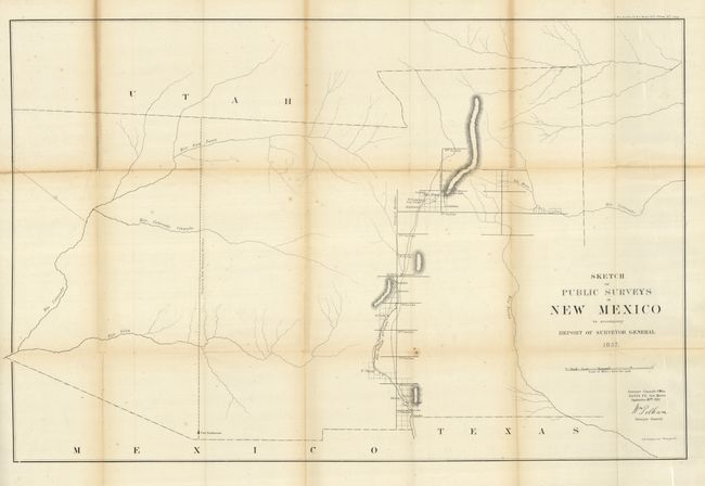
This lot is comprised of two of the earliest maps of the original huge New Mexico Territory which occupied most of the Southwest. Both are large-scale maps by the Surveyor Generals Office, Santa Fe, New Mexico. They show the territory at its fullest extent including all of present-day Arizona and parts of Nevada and Colorado. The 1856 issue expands slightly on the first public surveys of 1855 with the addition of three small surveys completed east of Santa Fe. It locates numerous Indian villages and reservations with very limited detail outside of the towns along the Principal and Guide Meridians. The 1857 map shows additional but minor survey progress along the Rio Grande River valley.
References:
Condition: B+
Both are folding, as issued. The 1856 map has a tear at binding side that extends into the map about 2", closed on verso, and a few spots along the horizontal fold. The 1857 map has some very light foxing and fold toning with split and one small area of loss at fold intersection split.