Subject: Eastern United States
Period: 1806 (dated)
Publication: New Universal Atlas
Color: Hand Color
Size:
20 x 17.8 inches
50.8 x 45.2 cm
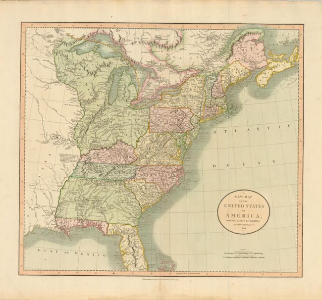
This handsome map is one of the best maps of the United States to appear in the early part of the nineteenth century. It covers the country from the Atlantic Ocean westward to the Mississippi River, beyond which is a small portion of Louisiana Territory. The huge Western Territory is comprised of today's Minnesota, Wisconsin, Illinois, Indiana, Ohio and Michigan. The 1795 Boundary Line by the Treaty of Grenville is delineated across present-day Ohio. The District of Main is drawn from the British point of view with the northern portion incorporated into Lower Canada and New Brunswick. The huge Georgia Territory stretches to the Mississippi River, incorporating present-day Alabama and Mississippi. Florida is divided into the Spanish possessions of East and West Florida. The map is filled with place names, forts, Indian villages and hunting grounds, roads and interesting notations.
References:
Condition: A
Map image is near fine with great original color and early, bright impression. Some marginal toning, more so along upper top edge.