Subject: Eastern United States
Period: 1798 (dated)
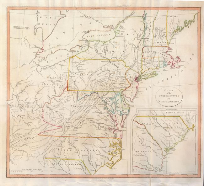
Publication: Travels Through the States of North America
Color: Hand Color
Size:
18.5 x 16.2 inches
47 x 41.1 cm
This map of the young United States is filled with great information on early development including roads and settlements. The map covers from the Province of Main through North Carolina with a large inset of South Carolina and Georgia. West of the states are the Western Territory and Kentucky. The villages of "Christian Indians" are located.
A member of the Irish gentry, Isaac Weld traveled to North America as a young man in search of adventure. He visited the settled regions of the eastern seaboard and then ventured into the hinterland with the assistance of Indian guides. Weld's account of his travels is one of the earliest illustrated amateur travel accounts to be devoted to North America. It was very popular and went through several editions in English and translations into French, German, Italian and Dutch.
References: McCorkle #798.5.
Condition: B+
Very fine color and impression. A little very light toning near the center and one short fold split that enters lower margin. With an uncommon watermark "17 Lepard 96."