Subject: Eastern United States and Canada, Texas
Period: 1845 (dated)
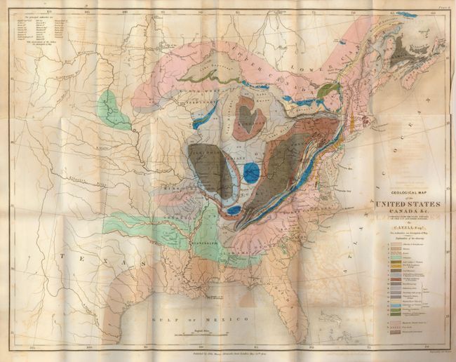
Publication: Travels in North American in the Years 1841-2; with Geological Observations…
Color: Hand Color
Size:
19.5 x 15 inches
49.5 x 38.1 cm
This is an important and early geological map by Sir Charles Lyell. Color-coded key identifies 20 different geological formations. The map extends to about the 110th meridian to include the Republic of Texas, Arkansas, Missouri and the North West Territory shown west of the Mississippi River. Lyell had two major and controversial goals in publishing his work and this map: first, he endeavored to establish a strict uniformitarian theory of the earth's geology, and also to standardize the terminology and methodology employed in the science of geology. His map is, along with James Hall's work of 1843, is a landmark improvement in geological representations and mapping.
References: Marcou and Marcou #34.
Condition: B
Folding as issued with a short tear at the binding trim. This appears to be an unused example with fine original color and dark, early impression. The map has overall offsetting from the dark impression.