Catalog Archive
Auction 127, Lot 12

"Die Erst General Tafel, Die Beschreibung und den Circkel des Gantzen Erdtrichs und Meers Innhaltende", Munster/Petri
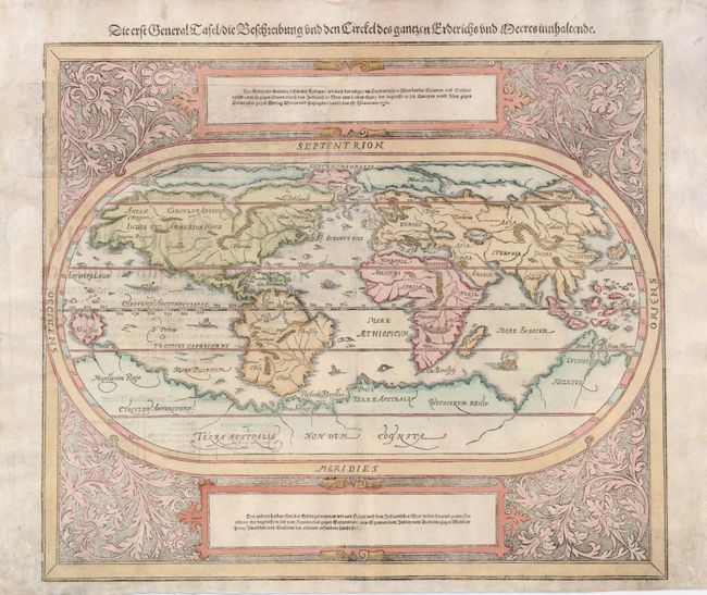
Subject: World

Period: 1598 (published)

Publication: Cosmographia

Color: Hand Color

Size:
14.3 x 12 inches
36.3 x 30.5 cm
Download High Resolution Image
(or just click on image to launch the Zoom viewer)

This oval woodcut world map appeared in the later editions of Munster's Cosmographia. The map of the "modern" world is based on Ortelius' map of 1570. It is surrounded by a floral and vine leaf pattern and two strapwork cartouches containing German text. The gothic German title is in the upper margin. Interesting cartographic features of the map include a huge southern continent and a Northern Passage (both Northwest and Northeast) to Asia. German text and illustration on verso.

References: Shirley #163.

Condition: B+

There is some professional paper restoration in the blank margins, which are lightly soiled. Minor show-through of the text on verso.

Estimate: $1,600 - $1,900

Sold for: $1,000

Closed on 2/25/2009

Archived