Subject: Canada
Period: 1757 (circa)
Publication: l'Histoire Generale des Voyages
Color: Black & White
Size:
11.7 x 7.4 inches
29.7 x 18.8 cm
This is a fine set of matching maps and a view from the same publication.
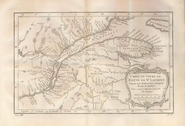
1) This map illustrates the course of the St. Lawrence River from Anticosti Island and the mouth west to beyond Quebec. It details rocks and shoals in the river and numerous villages and forts located along the shore. The map is decorated with a rococo-style cartouche with a distance scale. (11." x 7.4") Near fine with a hint of centerfold toning. (A)
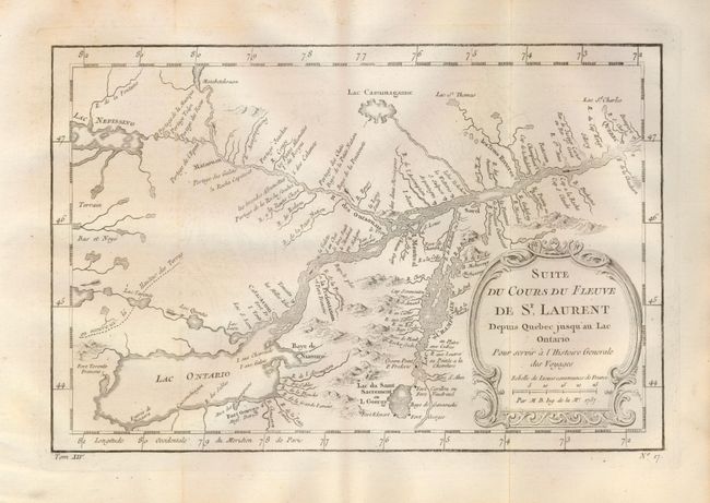
2) A detailed map of the region between Lake Ontario and the St. Lawrence River to Quebec. The map extends to Lake Champlain and Lake George, as well as Lake Nepessing in Michigan, with numerous portages named on the interconnecting waterways. There are a number of forts named, including Ft. Toronto, Ft. Oswego, and Ft. Georges. A rococo-style title cartouche encloses the distance scale. (11" x 7.3") Very nice example with a little marginal foxing and a hint of toning on one fold. (B+)
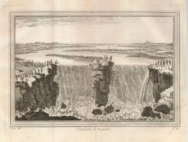
3) This boldly engraved view shows the falls with explorers in the foreground expressing disbelief. Surrounded by decorative keyboard-style border. (10.3" x 7") A little toning in upper margin and one nearly invisible area in lower right under border. (A)
References: 1) Kershaw #629; 2) Kershaw #634.
Condition:
See individual descriptions.