Subject: Canada
Period: 1687 (published)
Publication: De Nieuwe Groote Lichtende Zee-Fackel, Tweede Deel
Color: Hand Color
Size:
23.5 x 19.7 inches
59.7 x 50 cm
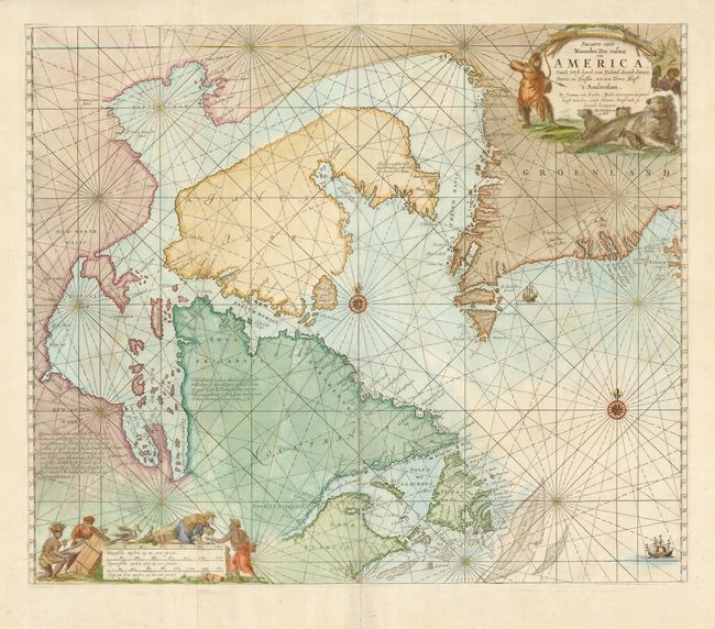
This is a great sea chart of Hudson Bay, Labrador, Newfoundland, James Island and Greenland. Compass roses, loxodromic lines, and ships decorate the oceans. The interesting title cartouche features a hunter fully dressed in fur stalking a bear and her cubs with bow and arrow. The scale of miles cartouche is adorned with a scene of Europeans trading with Native Americans. This map was first drawn in 1680 and is based on Doncker's final chart of Hudson Bay and the Arctic, with nearly identical cartouches. This is the second state with the "met Priviligie voor/ 15 Iaar" added to the cartouche and the error Teppa Nova in Newfoundland, instead of Terra Nova.
References: Kershaw #206; Phillips (A) #3444, Vol. 2, #43.
Condition: B+
Two sheets joined, as issued, with wide original margins. Repaired splits on centerfold that are a little irregular. Later color that is slightly uneven.