Subject: Colonial North America and Caribbean
Period: 1783 (dated)
Publication:
Color: Hand Color
Size:
25.5 x 19 inches
64.8 x 48.3 cm
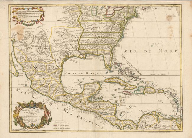
The title of this map contains a very early recognition of the newly formed United States, as 1783 is the earliest that the name appears on a printed map. This is the last issue of Delisle's map that was first issued in 1703. This map is regarded as the first map to accurately show the course of the Mississippi, accurately place the Great Lakes and locate many English coastal settlements. Its longevity and numerous copies by other mapmakers attest to the importance of this engraving. Dezauche was the son-in-law to Buache and the successor to the Delisle business. Dezauche has here altered the original title to include the words Etats Unis. He also added a legend and color-coding to show the colonial possessions of England, France, Spain and the extent of the United States.
References: Tooley (Amer) p.22 #53; cf Cumming (SE) #137; Martin (TX) p.92-3.
Condition: B
There are some light stains within the map.