Subject: Colonial North America and Caribbean
Period: 1777 (dated)
Publication:
Color: Hand Color
Size:
29.8 x 20.5 inches
75.7 x 52.1 cm
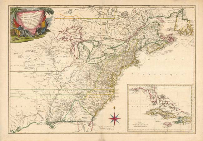
This rare and informative map covers the eastern half of North America from Hudson Bay to the Gulf of Mexico and includes an inset of southern Florida, the Bahamas, and the Greater Antilles. Based on the great Mitchell map of 1755, it presents very good detail of the colonies, cities and towns, forts, roads, Indian villages and tribal territory, and along the coastlines it depicts shoals and banks. Georgia is oddly shaped and incorporates much of present-day northern Florida. North Carolina and Virginia are shown with their boundaries extending west off the map. The information regarding the Indian territories and trading paths west of the Appalachian Mountains is excellent. A military scene complete with cannon forms the title cartouche. This map was issued again in 1778 and 1779 with a title change (Carte generale des colonies Angloises, dans l'Amerique Septentrionale. Par M. Phelippeaux…) It is occasionally seen on the market in those editions. However, we can find no record of this edition being on the market for the past 25 years.
References: McCorkle #777.18; Sellers & Van Ee #150.
Condition: B+
Fine impression. Overall very good with a couple insignificant light spots. The centerfold has been reinforced with tissue on the verso for no apparent reason that we can see except for a small repair of the centerfold in the blank margins.