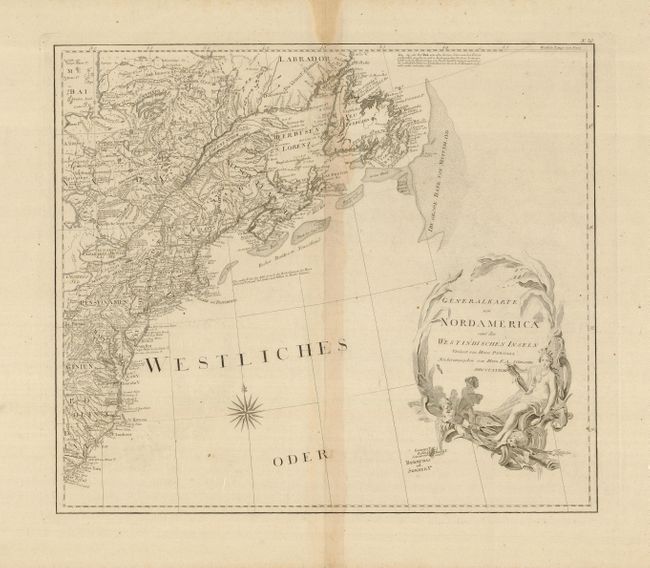
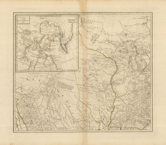
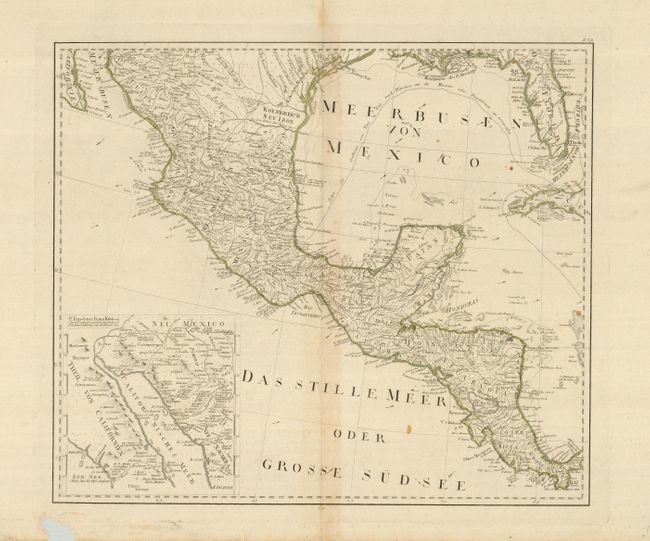
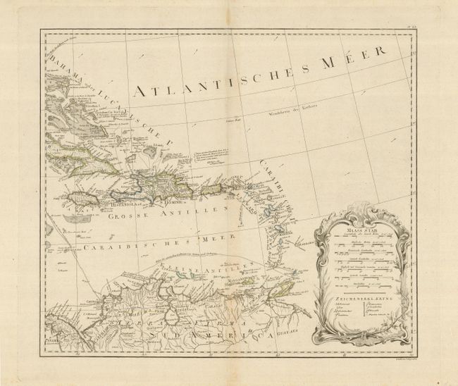
Subject: North America
Period: 1788 (dated)
Publication:
Color: Hand Color
Size:
23 x 19.8 inches
58.4 x 50.3 cm
This is a scarce Austrian map based on the important Bowen & Gibson map of North America and the West Indies (Sayer & Bennett 1783 edition) and updated to include the surveys of Governor Thomas Pownall. The map provides an extremely detailed view of the continent at the conclusion of the American Revolution. The United States is shown with its 1783 treaty border and the French and Spanish possessions are noted. It locates hundreds of settlements and Indian villages and is filled with interesting notations referring to native tribes and historical events. The settlement of Chikagu (Chicago) is noted on the shores of Lake Michigan. A number of roads are shown on the map stretching all the way to the Southwest and into Mexico. There are two interesting inset maps. One shows the discoveries of Father Eusebius Kino in the Southwest that proved that California was not an island. The other illustrates the ongoing search for a Northwest Passage, showing Baffin and Hudson Bays with the fictional See de Fonte reaching nearly to Baffin Bay. The map was engraved by J. Stenger. Printed on four sheets (approximate dimensions given are for each sheet); if joined the map would measure approximately 40 x 46".
References: McCorkle #788.6 (title sheet); cf Stevens & Tree #49; cf Wheat #196 (English version).
Condition: B
Each sheet with huge margins on thick paper, one sheet with large text-based watermark. Centerfolds are toned, otherwise generally very good. The sheet with Mexico and Central America has 1" area of loss in lower blank margin, well away from neatline.