Subject: Atlas, Revolutionary War
Period: 1807 (published)
Publication:
Color: Black & White
Size:
9 x 11 inches
22.9 x 27.9 cm
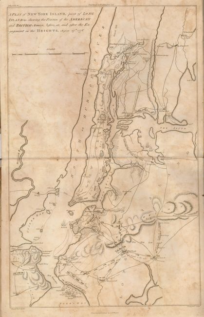
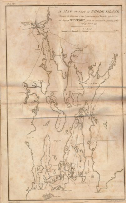
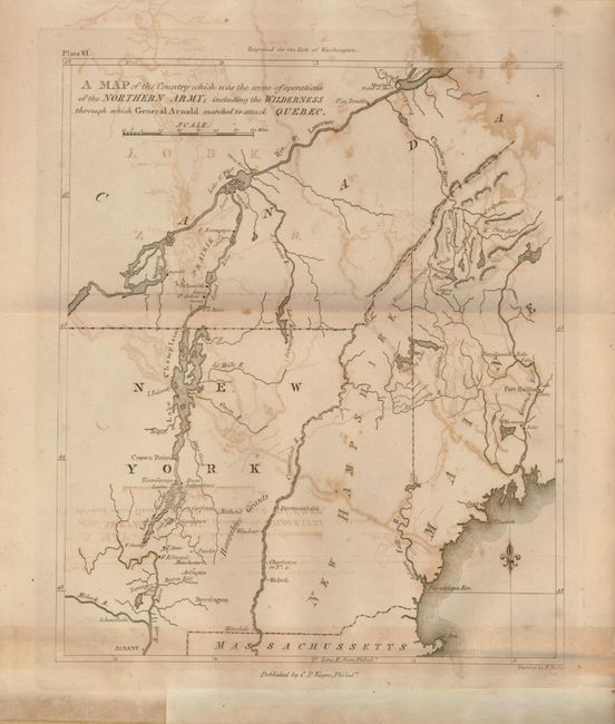
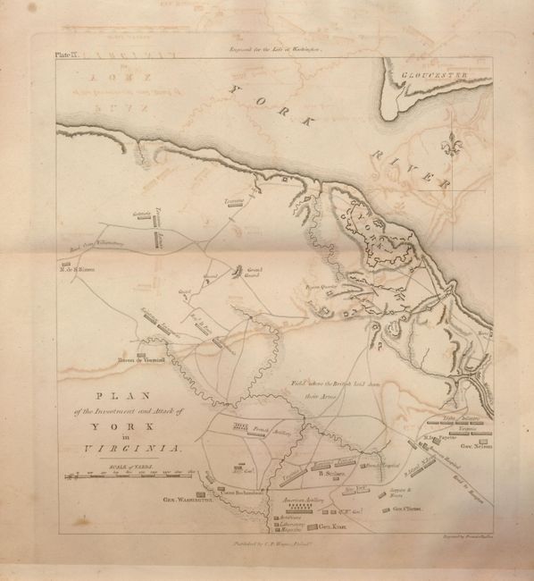
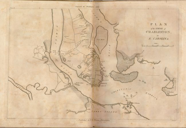
This is the rare atlas volume to The Life of George Washington which was published in six volumes, 1805-07. The atlas volume, dated 1807, contains ten engraved folding maps of important Revolutionary War cities, battlefields and troop movement plans. The maps are: 1) Boston with its Environs; 2) A Plan of New York Islands, part of Long Island &c. shewing the Position of the American and British Armies…August 27th 1776; 3) A Plan of the Country from Frog's Point to Croton River shewing the Positions of the American and British Armies..on the White Plains on the 28th; 4) A Plan of the Northern Part of New Jersey, shewing the Positions of the American and British armies after crossing the North River in 1776; 5) A Map of the Country from Rariton River in East Jersey to Elk Head in Maryland…; 6) A Map of those parts of Virginia, North Carolina, South Carolina, & Georgia which were the scenes of the most important Operations of the Southern Armies; 7) A Map of part of Rhode Island Shewing the Positions of the American and British Armies at the Siege of Newport…29th August 1778; 8) A Map of the Country which was the scene of operations of the Northern Army; including the Wilderness through which General Arnold marched to attack Quebec; 9) Plan of the Investment and Attack of York in Virginia; and 10) Plan of the Siege of Charleston in S. Carolina. While this publication was written by Chief Justice John Marshall, the atlas volume was published by C.P. Wayne of Philadelphia whose name appears on each map. Quarto, marbled paper boards. It is rare to find the atlas volume intact and complete.
References:
Condition: B
Front cover is nearly loose. Covers are worn and all maps and pages are foxed and with offsetting. Owner's name on title page and front paper label. All maps should be cleaned and rebound.