Subject: Holy Land
Period: 1643 (circa)
Publication:
Color: Hand Color
Size:
19.5 x 11.5 inches
49.5 x 29.2 cm
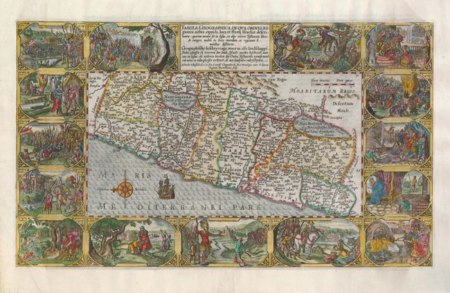
This is one of the most decorative maps of Israel from a Dutch Bible. The map covers the region from Sidon to Rinocoruru and is oriented with north to the left. The Kishon River connects the Mediterranean with the Lake of Tiberia. The area is divided among the twelve tribes and is filled with place names and regions as mentioned in the Book of Joshua. Fifteen vignettes from the Book of Joshua surround the map including a scene of the battle between David and Goliath. Dutch text on verso.
References: Laor #567; Poortman & Augusteijn #78.
Condition: B+
The side margins of Bible maps are often damaged, as was the case with this map. They have been expertly restored using the leaf-casting method and the missing images in the bottom corners have been skillfully replaced. The restoration can only be seen on very close examination.