Catalog Archive
Auction 126, Lot 470

"Das Engelland mit dem Anstossenden Reich Schottlandt so vor Zeiten Albion und Britannia haben Geheissen", Munster, Sebastian

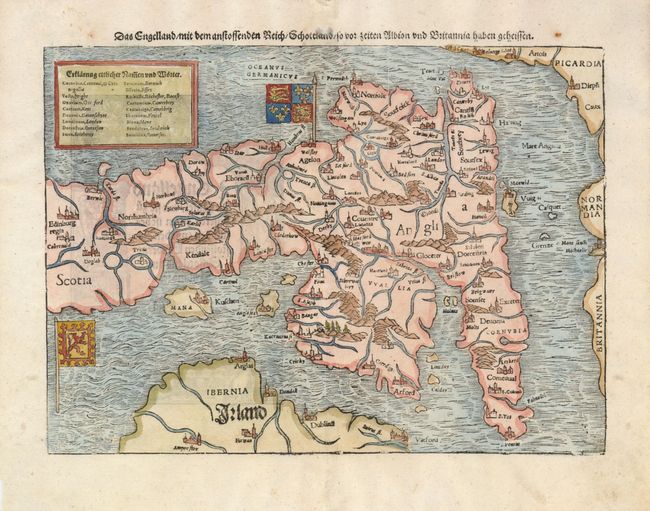
Subject: England & Wales

Period: 1578 (published)

Publication: Cosmographie

Color: Hand Color

Size:
13.5 x 10 inches
34.3 x 25.4 cm
Download High Resolution Image
(or just click on image to launch the Zoom viewer)

This early and unusual portrayal has north oriented to the left of the map. The woodblock map is filled with exaggerated topographical features with large castles denoting the cities. This map was a great improvement over previous maps of the region and showed for the first time several city names. At upper left is a key to the Latin and English place names. The flags of both England and Scotland are shown. This is the German edition of the map originally titled Anglia II Nova Tabula. German title block and text on verso contained in an architectural illustration.

References:

Condition: A

The centerfold has been professionally reinforced with light tissue on verso and there are a few spots in the margins.

Estimate: $550 - $650

Sold for: $400

Closed on 12/3/2008

Archived