Subject: England
Period: 1680 (circa)
Publication: Brittania
Color: Hand Color
Size:
17 x 12.5 inches
43.2 x 31.8 cm
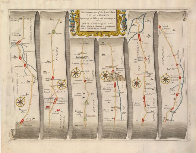
John Ogilby's 'Britannia' was published between 1675 and 1698. It is a landmark in the mapping of England and Wales. Its unique format constituted the first national road-atlas of any country in Western Europe. It was composed of maps of seventy-three major roads and cross-roads, presented in a continuous strip-form, on a uniform scale of one inch to a mile. Each beautiful map includes wonderful detail of the countryside with each strip containing a large compass rose to indicate changes in direction.
Handsome road map in the pictorial style pioneered by Ogilby with the road laid out in several ribbon-like panels. The map begins in Stilton (mile 69 from London) and proceeds in a northerly direction, through Sherwood Forest and several small towns to Tuxford at mile 131. Along the route are Stamford, Grantham, Newark and more. Each of the six panels has a decorative compass rose to orient the traveler. The title cartouche is in a strapwork and garland style. This is "Plate the 2d", with the previous one detailing the first 69 miles from London to Stilton.
References:
Condition: B+
Full margins. A small printer's crease at lower edge just enters the fifth panel.