Subject: World
Period: 1746 (dated)
Publication:
Color: Hand Color
Size:
21.5 x 18 inches
54.6 x 45.7 cm
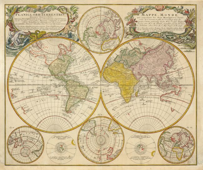
This handsome double hemisphere world map was drawn by Georg Moritz Lowitz, based on the work of Johann Mathias Haas. It includes four polar spheres, each in a different projection, and two interesting diagrams depicting the earth, as it would be seen from space. This is a later (circa 1760), more interesting version with the coast above California revised to show an early Alaskan Peninsula based on Mueller's important map. In the South Pacific there are partial coastlines of New Zealand and Australia. Two very large, decorative cartouches contain the titles, one in Latin, the other French. The Latin cartouche features mythical sea creatures and the other is surrounded by fruit and animals representing the bounty of the earth.
References:
Condition: B+
There is some minor soil in the bottom corners. The bottom margin has been professionally replaced with a bit of the neatline in facsimile.