Subject: Michigan, Detroit
Period: 1764 (circa)
Publication: Petite Atlas Maritime
Color: Black & White
Size:
12.5 x 8.2 inches
31.8 x 20.8 cm
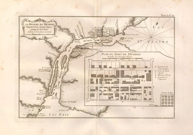
This fine map is the first printed map of Detroit. It was published after the French lost control of the Great Lakes forts to the British during the French and Indian War. It is based on two manuscript maps by Joseph Gaspard Chaussegros de Lery; "Plan du Fort Detroit" (1749) and "La Riviere du Detroit" (1752). The map depicts the Detroit River between Lake Erie and Lake St. Clair with farms along both banks, the location of the fort, settlements and Indian villages. The inset plan of the fort delineates the various streets and buildings within the fortification and shows the garden outside of its protective walls. Rococo-style title cartouche with distance scale.
References: Tooley (Amer) p. 210 #114; Sellers & Van Ee #777; Karpinski (MI) p.154-5.
Condition: B+
Good impression on a thick sheet of hand laid paper with very wide margins and large watermark. Some marginal foxing with a couple spots rudely entering the map.