Catalog Archive
Auction 126, Lot 257

"Preliminary Chart of Entrance to San Francisco Bay California", U.S. Coast Survey

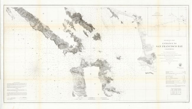
Subject: California, San Francisco

Period: 1856 (dated)

Publication: Annual Report of the Superintendent of the United States Coast Survey

Color: Black & White

Size:
38.5 x 20.3 inches
97.8 x 51.6 cm
Download High Resolution Image
(or just click on image to launch the Zoom viewer)

This great coastal chart of the San Francisco Bay covers the Marin Peninsula, San Francisco, Mission de Dolores, and the eastern coastline from just above Brookes Island to San Antonio Creek. An early city plan of San Francisco and an inset, "Sub-Sketch of Entrance to San Francisco Bay" add interest. There is good detail along the shore and sailing directions, soundings and navigational hazards are described in text.

References: cf Wheat [TMW] #427.

Condition: B+

A very nice example which has been pressed and small fold intersection well repaired on verso. Full margins, bright impression and clean paper with just a little light toning on some folds.

Estimate: $150 - $200

Sold for: $110

Closed on 12/3/2008

Archived