Subject: Western United States
Period: 1858 (dated)
Publication: Illustrated Cabinet Atlas
Color: Hand Color
Size:
10.8 x 12.8 inches
27.4 x 32.5 cm
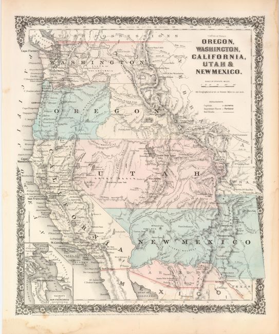
This map of the west is similar in coverage to Mitchell's map published 1846 - 1854. This period in westward expansion provided some interesting territory boundaries. Washington and Oregon extend to the Continental Divide. The huge Utah Territory extends from Longs Peak in today's Colorado to California. The large New Mexico Territory spans between Texas and California. The Gadsden Purchase area is here called Arizona, illustrating the early proposals before Congress to establish the region prior to the Civil War. Maps from the Cabinet Atlas are uncommon and are bounded by a unique floral border.
References:
Condition: B+
Map image is near fine. A little marginal foxing or staining with a few foxing marks just inside map at bottom.