Subject: Mid-Atlantic, Pennsylvania & Maryland
Period: 1865 (dated)
Publication: Oil Regions of Pennsylvania and West Virginia
Color: Printed Color
This rare set of maps of the coal fields are the companions to the oil maps presented in Sweet's elusive report on the oil regions of Pennsylvania and West Virginia. Each map is folding, printed in blue ink with light brown overprinting to indicate coal reserves. Each is highly detailed. The lot includes the following:
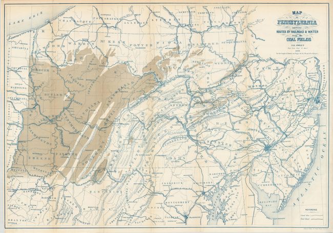
1) "Map of Pennsylvania Shewing Routes by Railroad & Water from the Coal Fields" (30 x 20.8"). Includes part of New York, New Jersey and Maryland. Extensive portion of western Pennsylvania indicates coal reserves. Tiny tear at binding trim. (A)
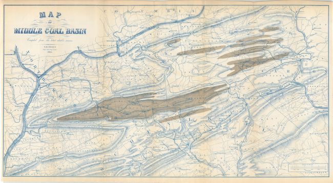
2) "Map of Middle Coal Basin" (28.5 x 15"). Extremely detailed on a scale of approximately 1.75 miles per inch, this map is centered on Mount Carmel showing much of the region covered with coal. The larger towns located are Bloomburg, Northcumberland, and Pottsville. Fine (A+).
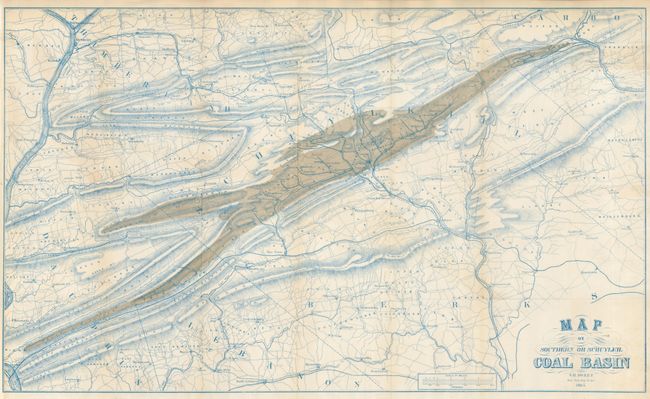
3) "Map of Southern or Schuylkil Coal Basin" (28.5 x 17"). Extremely detailed on a scale of approximately 1.75 miles per inch, the map is centered on Pottsville and names North Lebanon, Sunbury, Hamburg and many more. Fine (A+).
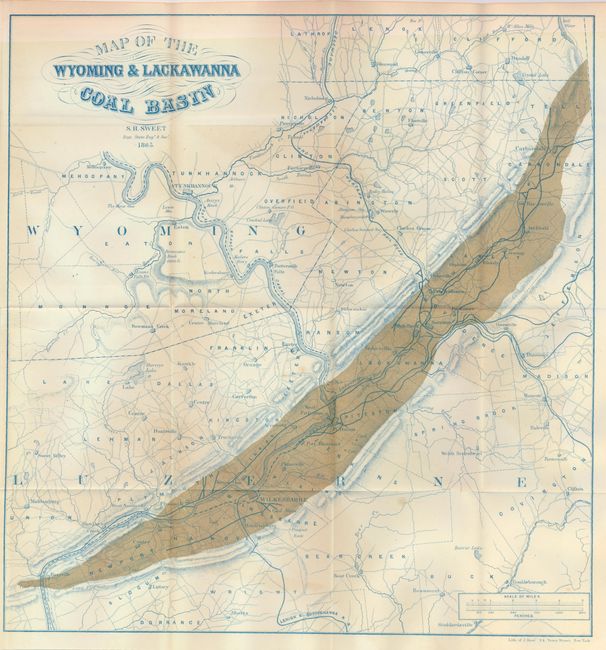
4) "Map of the Wyoming & Lackawanna Coal Basin" (15.6 x 16.5"). Extremely detailed on a scale of approximately 1.75 miles per inch, map is roughly centered on Pittston and names Wilkesbarre, Tuckhannock, Providence and Carbondale. With a light shadow of offsetting from the strong coloring applied to the coal (B+).
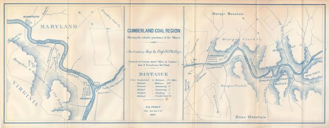
5) "Cumberland Coal Region Shewing the Relative Positions of the Mines...Interval of Country about 7 Miles by Cumberland & Pennsylvania Rail Road" (22 x 8.2") This coal mining map shows Maryland and northern Virginia. The map has two panels: the first shows the Piedmont area at the confluence of the North Branch of the Potomac River and Georges Creek. The right panel the various coal holdings along Georges Creek near Dans Mountain. Both name property owners, roads, topography, and railroads. One spot (A).
References:
Condition:
See individual descriptions.