Subject: Colonial Mid-Atlantic
Period: 1747 (circa)
Publication: Allgemeine Historie der Reisen zu Wasser und Lande
Color: Black & White
Size:
11.1 x 7.3 inches
28.2 x 18.5 cm
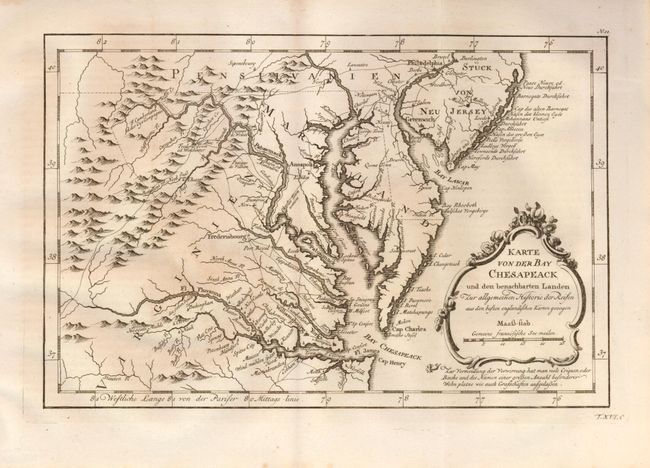
This is a German edition of Bellin's map for Prevost's Voyages published by Arkstee and Merkus as evidenced by No. 11 outside the top neatline. Based on the Jefferson/Fry map of 1754, it is a finely engraved map of the region of Virginia, Maryland and Delaware and presents a detailed view of early colonial settlement, roads and trails. The map covers the area from Philadelphia to Cape Henry and from the Atlantic to western Maryland. The boundary lines between Maryland and Delaware, Pennsylvania and Virginia are either wholly or partly shown by dotted lines. The Fairfax Grant Line in shown. The decorative cartouche has an engraving of a right hand pointing to the notation under the cartouche.
References:
Condition: A
Folding as issued with a strong, early impression. Some very light foxing in left portion, otherwise a fine example on a full sheet with wide margins.