Subject: Eastern United States, Civil War
Period: 1861 (dated)
Publication: Weekly Dispatch Atlas
Color: Hand Color
Size:
25 x 17 inches
63.5 x 43.2 cm
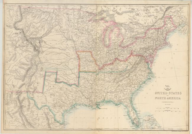
This great Civil Warmap covers the country from the Rocky Mountains to the Atlantic seaboard. Of importance is the designation of the separate Confederate and Union states via hand coloring. The states of Missouri and Kentucky are colored differently to indicate their status as border states containing both pro-Confederate and pro-Union government factions. The Confederate Territory of Arizona is shown in the south of New Mexico Territory. The map is finely engraved and detailed, and it shows existing railroads and several possible routes explored for the proposed Pacific Railroads. The tracks of Fremont, Gunnison and others are shown, as are numerous roads, marshes, forts and Indian tribes. These maps were published in the serial Weekly Dispatch Atlas for later binding into a world atlas, and examples still folding and unbound are uncommon. Published by Cassell, Petier & Galpin, la Belle Sauvage Yard, Ludgate Hill for inclusion in the Weekly Dispatch Atlas.
References:
Condition: A
Issued folding, now pressed and backed with archival tissue. A few spots a lower center. A nice example.