Subject: United States, Native Americans
Period: 1833-1920 (dated)
Publication:
Color:
A nice set of folding maps that show the evolution of Indian Reservations in the United States over a period of 97 years.
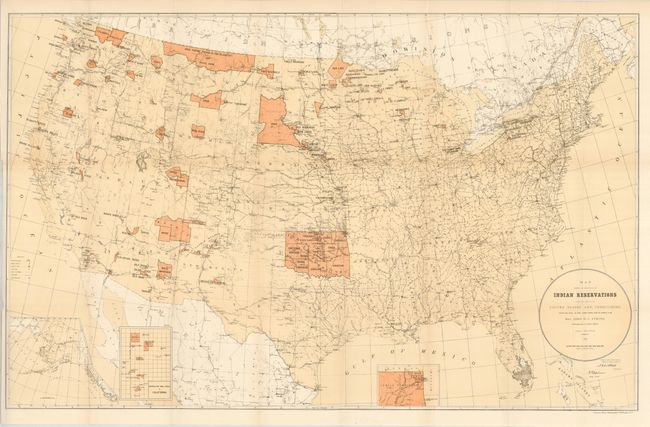
1) Map Showing Indian Reservations within the Limits of the United States and Territories Compiled from Official and Other Authentic Sources, under the Direction of the Hon. John D.C. Atkins, Commissioner of Indian Affairs. Paul Brodie Draughtsman. 1895., printed color (33.5 x 21") Folding, as issued on thick paper. With a short tear at binding trim and another at upper left, both closed on verso. (B)
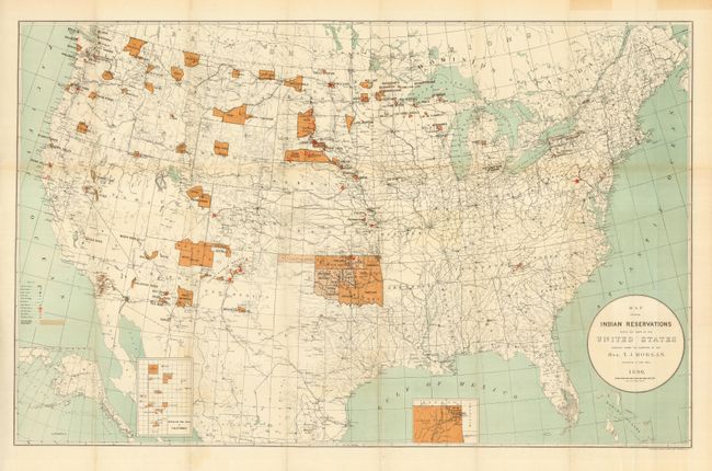
2) Map Showing Indian Reservations within the Limits of the United States Compiled under the Direction of Hon. T.J. Morgan. Commissioner of Indian Affairs 1890, printed color (33.3 x 21"). This graphic map shows reservations across the United States and locates towns, railroads, military stations, schools, and Indian agencies. There are insets of Indian Territory, Mission Ind. Res. of California, and Alaska. Lithography by Norris Peters Co., Washington D.C. Folding, as issued. A little toning along one fold and a ghost of offsetting or very light toning at bottom in Mexico (B+).
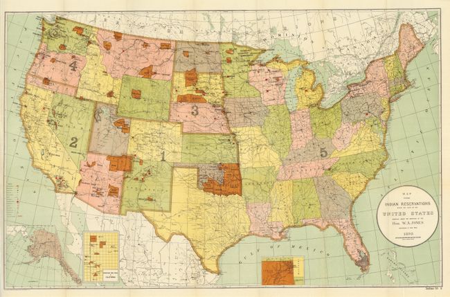
3) Map Showing Indian Reservations within the Limits of the United States Compiled under the Direction of Hon. W. A. Jones. Commissioner of Indian Affairs. 1898, printed color (33 x 21"). Colorful map shows reservations across the United States and locates towns, railroads, military stations, schools, asylums and Indian agencies. This map also has insets of Oklahoma, Mission Ind. Res. of California, and Alaska. Folding, as issued. Beautiful example (A+).
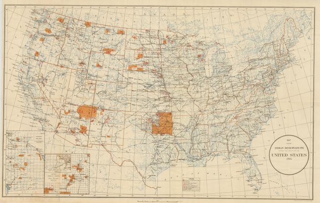
4) Map Showing Indian Reservations within the Limits of the United States 1914 , printed color, (24.3 x 15"). Legend features schools. Insets of Mission Ind. Res. in California and Indian Pueblo Grants in New Mexico. Near fine with just a short area of toning on one fold (A).
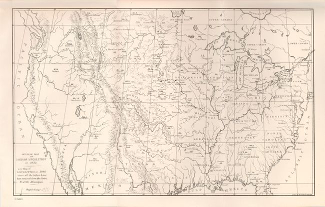
5) Outline Map of the Indian Localities in 1833. George Catlin, uncolored (13 x 8"). This great map was published in an edition of Catlin's Indian Gallery. The map names scores of Indian villages, designated by tepee symbols. The map extends well into Canada, locating numerous Canadian tribes. There is good detail of watershed and the known mountain ranges. The West is mostly blank and contains erroneous information in the Great Basin region derived from Fremont's map, including an east-west flowing river. Texas is shown with its northern border extending well into the Rocky Mountains, but it is indistinct at its upper reaches. Of special interest is the depiction of the Buffalo Range that stretches throughout the entire plains region. Fine condition (A+), folding as issued.
References:
Condition:
See individual descriptions.