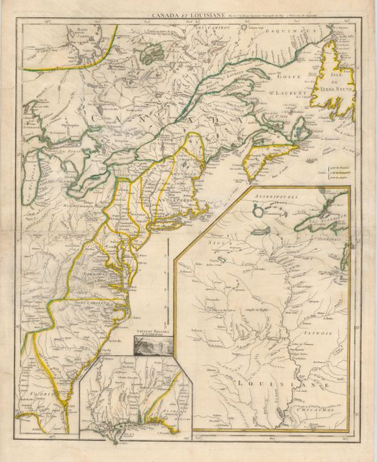
Subject: Colonial United States and Canada
Period: 1755 (circa)
Publication: Recueil Contenant Cartes Nouvelles…
Color: Hand Color
Size:
19.5 x 24.3 inches
49.5 x 61.7 cm
This important map was issued at the outbreak of hostilities in the French and Indian War. The detailed map depicts the entire eastern seaboard from northern Florida to the Strait of Belle Isle, and the Great Lakes region up to Lake Michigan and eastern Lake Superior. The American interests of France, England and Spain are shown in great detail and color-coded. Fort Duquesne is shown in two different places on the map - according to D’Anville and also to Jefferys. A large inset shows the upper Mississippi River valley with the important frontier forts. A smaller inset shows the lower Mississippi and Gulf Coast. A small vignette of Niagara Falls adds further interest to this fascinating map. This is the first state of four. The later issues have revised titles.
References: McCorkle #755.23; Sellers and Van Ee #33.
Condition: B
There is a small, unobtrusive hole in a blank area near Cape Cod and some short tears in the margins and the centerfold. The map has been backed with 18th century paper, apparently for binding into a composite atlas. The backing repairs all the flaws.