Catalog Archive
Auction 126, Lot 119

"Canada ou Nouvelle France", Mallet, Alain Manesson

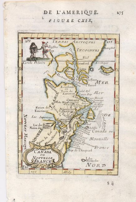
Subject: Colonial United States and Canada

Period: 1683 (circa)

Publication: Description de l'Univers

Color: Hand Color

Size:
4 x 5.5 inches
10.2 x 14 cm
Download High Resolution Image
(or just click on image to launch the Zoom viewer)

This charming small map depicts the eastern seaboard from Chesapeake Bay to Greenland. The Great Lakes are shown open-ended in the west allowing the possibility of a Northwest Passage. The map extends to include Bermuda. Names Lake Superior, the Cercle Polaire and shows Nouveu Mexique at extreme lower left. The map is decorated with a strap work title cartouche at lower left and a vignette at upper left shows two Indians and an infant. Page number 275 at upper right and French text on verso.

References: Kershaw #267; McCorkle #683.3.

Condition: A

Good impression and well applied hand color.

Estimate: $200 - $250

Sold for: $210

Closed on 12/3/2008

Archived