Subject: Canada, Quebec
Period: 1759 (published)
Publication: Gentleman's Magazine
Color: Black & White
Size:
7.3 x 4.3 inches
18.5 x 10.9 cm
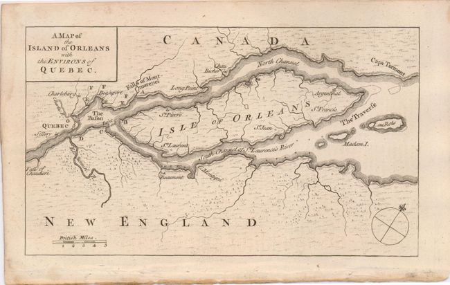
This uncommon French and Indian War map was published in the October 1759 edition of Gentleman's Magazine. At the time Quebec was France's strongest fortress in Canada. The nearly three month long siege ended on September 18th, 1759, when the French surrendered to the British General Wolfe. This victory was the turning point of the war. Centered on the Isle of Orleans the map locates Quebec, The Bason, Cape Torment, The Traverse, Beaumont, and the falls of Chaudiere and Montmorenci. British scale of miles and simple compass rose.
References: Jolly GENT-136.
Condition: A
Very crisp impression and original margins. A little toning along extreme lower edge and a hint of toning or staining in title block, else fine.