Subject: Canada, Nova Scotia
Period: 1744 (dated)
Publication: Allgemeine Historie der Reisen zu Wasser und zu Lande
Color: Hand Color
Three fine charts of important ports in Nova Scotia from the German edition published by Askstee & Merkus in 1756. Each chart is oriented with a large compass rose.
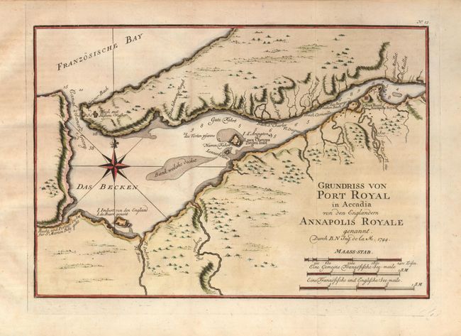
1) Grundriss von Port Royal in Accadia… (11 x 7.5") details the region around Port Royal including the walled Fort Royal, topography and watershed, islands and shoals in the vicinity.
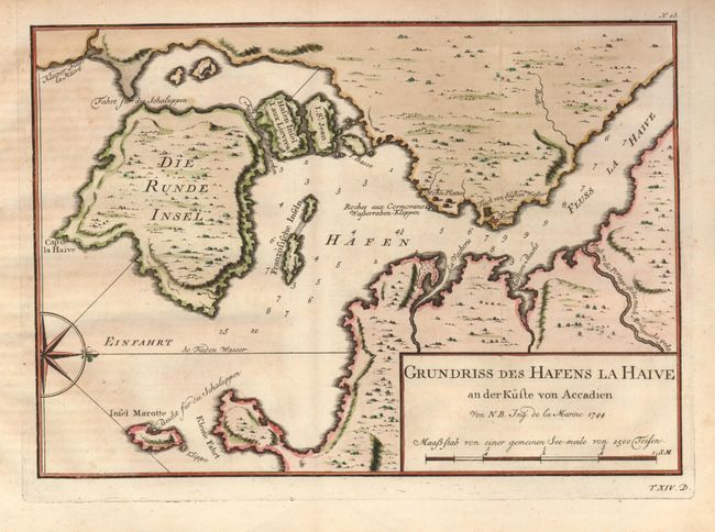
2) Grundriss des Hafens la Haive an der Kuste von Accadien (11 x 7.8") focuses on the vicinity of Lahave on the southern coast and locates the Fort Point and the small settlement at the mouth of the Lahave River. The chart is oriented with north to the right.
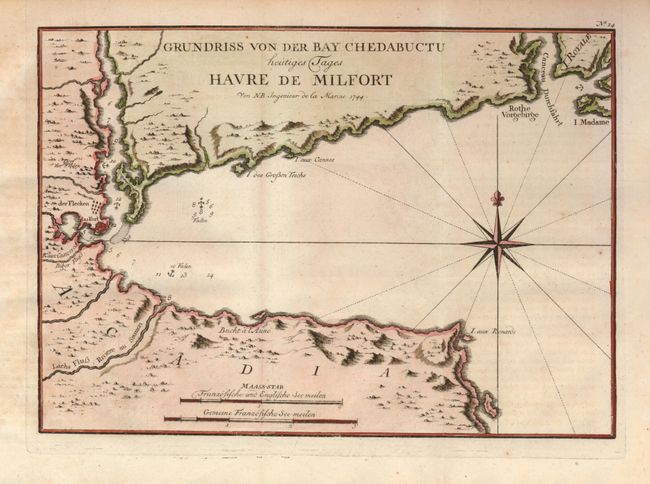
3) Grundriss von der Bay Chedabuctu heutiges Tages Havre de Milfort (11 x 8") shows Chedabucto Bay on Nova Scotia’s eastern coast close to the Canceau Passage between Nova Scotia (Accadie) and (Isle Royale). Chedabucto Bay was also named Milfort Harbor. A small fort (Fort St. Louis) and fishing village are shown at the head of the bay, on the site of the present day Guysborough.
References: Kershaw #770, 771, & 772.
Condition: A
Issued folding, now flattened with a bit of faint toning, overall very good.