Subject: North America, Texas
Period: 1840 (circa)
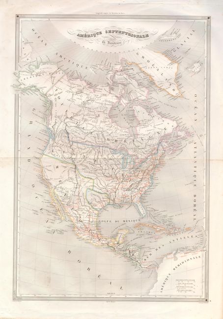
Publication: Atlas Universel Geographie
Color: Hand Color
Size:
14 x 20.5 inches
35.6 x 52.1 cm
This detailed map features the Independent Republic of Texas. In Texas the only towns named are S. Antonio de Bejar, Ming, S. Felippe de Austin, and Nacodoches. The unique feature of this map is the use of orange overprinting to label some towns and to delineate the extensive wagon road network. This French map portrays the United States extending well into British Columbia, cartographically taking the side of the United States as the French normally did at this time in history. Alaska is Amerique Russe and all of Canada is Nouvelle Bretagne. Mexico controls the Southwest up to the District de Oregon. The map has good detail throughout including Indian names, watershed, railroads, forts, roads, etc. Fancy titling with flourishes, ruled border and four distance scales embellish the map. We find no references or prior pricing records for this map.
References:
Condition: B+
Fine original outline color. A spot or smudge at lower left and some manuscript ink notations in Alaska, otherwise very good.