Subject: Asia, Sri Lanka, Indonesia
Period: 1704-80 (circa)
Publication:
Color: Hand Color
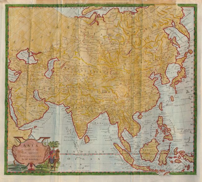
1) Asia, Agreeable to the Most Approved Maps and Charts by Thomas Kitchin, Millar's New Complete & Universal System of Geography, circa 1780 (14.8 x 13"). This nice map represents the state of knowledge in the late eighteenth century. The islands of Japan are beginning to take on the proper shape, although Companies Land still appears as a large island in the Kuril chain. The East Indies are especially well-documented as a result of the long established European presence in the region.
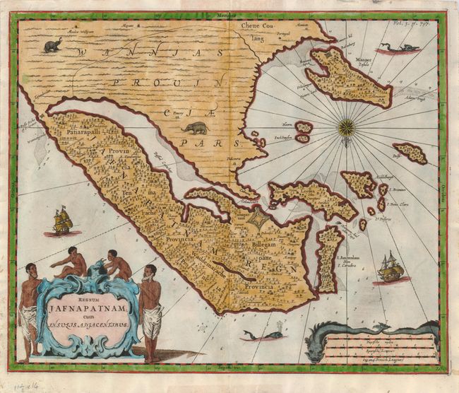
2) Regnum Jafnapatnam cum Insulis Adjacentibus from John Churchill's A Collection of Voyages and Travels, circa 1704 (13.8 x 11.5"). This copper engraved map covers the Jaffna kingdom in the northern part of Sri Lanka. Fort Jafnapatnam, captured by the Dutch in 1658, is prominently depicted. The map is oriented with north at the bottom. It is embellished with elephants, sea monsters, sailing ships and a compass rose. The large title cartouche features men and children and the distance scale is enclosed by a pair of sea monsters. There is some tape residue on verso paper edges.
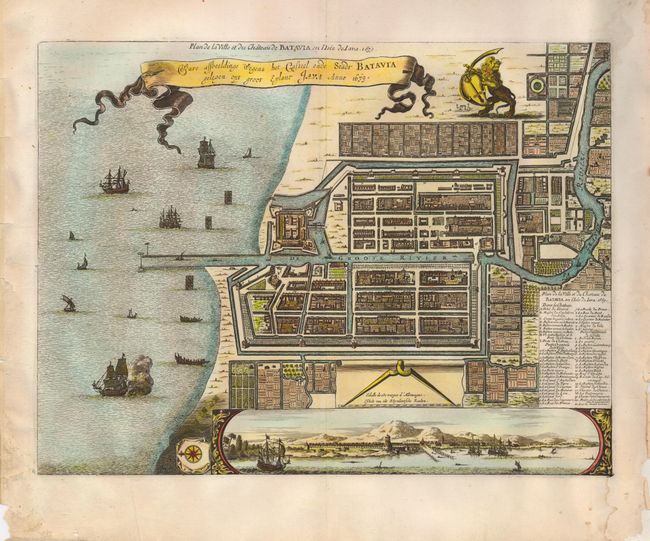
3) Ware Affbeelindge Wegens het Casteel ende Stadt Batavia Gelegen opt Groot Eylant Java Anno 1679, by Pierre van der Aa, circa 1730 (14 x 10.5"). This detailed plan of Batavia (Jakarta), the Dutch capital in the East Indies, was based on Clement de Jonghe's map of 1650 except for a modification of the coastline in front of the fortress. The city is laid out in typical Dutch style with an extensive network of canals. The title is contained in a banner beside the Dutch lion with the French title, Plan de la Ville et du Chateau de Batavia en l'Isle de Iava 1679 above and in the map key.
References:
Condition: B
There is tape residue on the verso of the first two maps with the resulting stain encroaching into the top border of the map of Asia. There are some marginal tears and some paper tape in the lower right corner of the map of Jakarta. Otherwise the maps are attractive with later coloring.