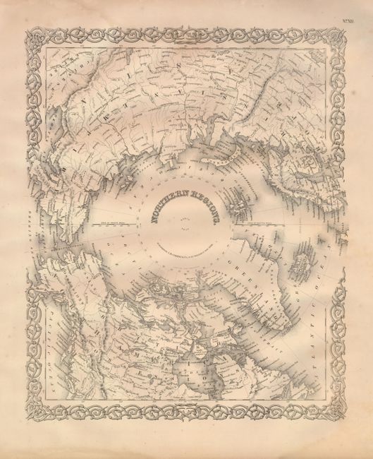
Subject: North Pole
Period: 1855 (dated)
Publication: Illustrated Atlas of the World
Color: Black & White
Size:
15.7 x 12.7 inches
39.9 x 32.3 cm
This beautifully engraved map details the hemisphere as far south as Puget Sound, Newfoundland, Stockholm, and the northern reaches of the Caspian Sea. Alaska is Russian Possessions. Above the Spitzbergen group, Ross Island is noted as the "highest known land." The map is surrounded by Colton's distinctive scroll-style border. This map was published in the first edition of Colton's monumental world atlas in 1856. This is the single-page sheet as distinguished from the later sheet that combines both poles.
References:
Condition: B+
Fine, dark impression with full, original margins. A little marginal toning and a few very light areas of foxing or toning.