Subject: Michigan
Period: 1869 (dated)
Publication: Manual for the Use of the Legislature of the State of Michigan
Color: Hand Color
Size:
16.7 x 17.3 inches
42.4 x 43.9 cm
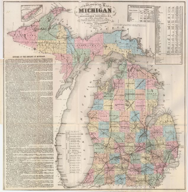
This folding map shows hand colored counties, with census tables for each county and a small inset of Isle Royale. The eighteen different geological formations are shown in an unusual fashion by iso-lines and numbers keyed to the legend. We've never seen this technique as geological formations are normally shown via color and grid. Winchell was the State Geologist for Michigan. Unlisted in Marcou & Marcou's Mapoteca Geological Americana who list a number of geological maps covering portions of Michigan, also by Winchell, (both earlier and later than 1869) but none cover the whole state, thus this may qualify as the first geological map of Michigan. Long text at left is "Epitome of the Geology of Michigan." Beautifully colored and printed on fine banknote-style paper. Published in Doylestown, Pennsylvania.
References:
Condition: A
Folding as issued. Excellent original full coloring and dark impression. Near fine example has a couple tiny spots in blank areas outside of map.