Subject: East Indies - Indonesia
Period: 1773 (published)
Publication: Atlas Portatif…
Color: Hand Color
Size:
17.3 x 8 inches
43.9 x 20.3 cm
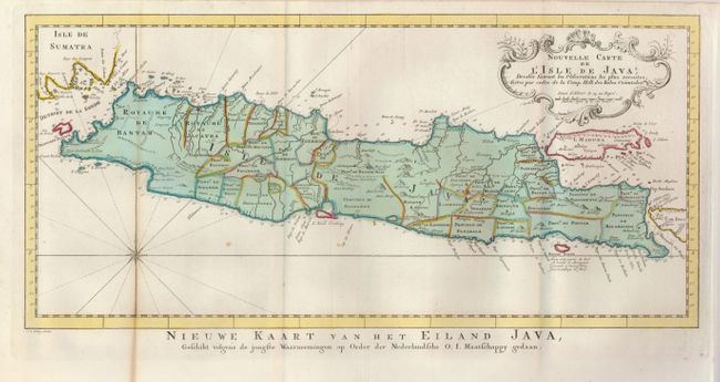
1) Attractive chart of the island depicting soundings around the coast, all principal harbors, rivers and elevations, bays and points, settlements and provinces. Included are Madura, Bali, Sunda Strait and the southeastern tip of Sumatra. The island is divided into provinces and the kingdoms of Bantam, Tsieribon and Jacatra. Java was the center of the Dutch trading empire in Southeast Asia. A nice compass rose and decorative title cartouche complete the map. Titled in Dutch below the map: Nieuwe Kaart van het Eiland Java...
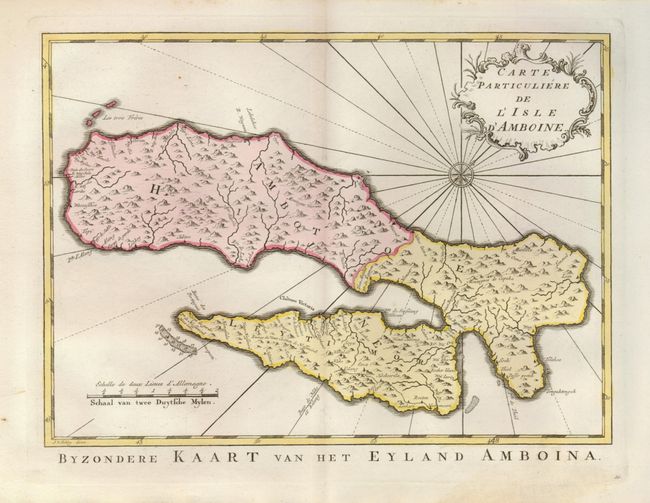
2) Another handsome map showing Ambon, in the Moluccas Islands, better known as the Spice Islands. These islands were of tremendous importance for their spice production of nutmeg, cloves, also fine woods, fruits, etc., and were long fought over by European powers. The map is delicately engraved with rhumb lines radiating out from the compass rose. Dutch title below: Byzondere Kaart van het Eyland Amboina.
References:
Condition:
1) with slight toning along one fold - B+. 2) Fine - A+.