Catalog Archive
Auction 124, Lot 65

"A New Projection of the Western Hemisphere of the Earth on a Plane (shewing the proportions of its several parts nearly as on a Globe)", Bowen, Thomas

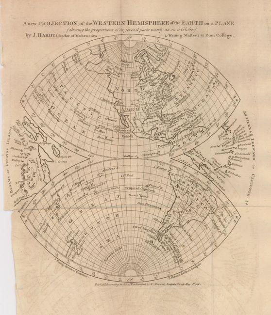
Subject: Western Hemisphere

Period: 1776 (dated)

Publication: Gentlemen's Magazine

Color: Black & White

Size:
9 x 9.3 inches
22.9 x 23.6 cm
Download High Resolution Image
(or just click on image to launch the Zoom viewer)

This map presents the hemisphere on an unusual projection developed by John Hardy of Eton College. The map is split into two football-shaped halves with the Caribbean islands nestled in the spaces between. The colonies of Virginia, North and South Carolina and Georgia are shown with their western boundaries on the Mississippi River. The Pacific Northwest is elongated with the Alaskan region greatly distorted. The map was engraved and drawn by Thomas Bowen.

References: Jolly GENT-244.

Condition: B

A nice impression on a sheet with folds as issued. There is a short binding tear just into the left side and some light offsetting.

Estimate: $120 - $150

Sold for: $90

Closed on 5/7/2008

Archived